
Mackay Country
Dùthaich Mhic Aoidh
An area in North-West Scotland of natural unspoiled beauty, rich in heritage & history
Armadale

Armadale is a crofting and fishing township on the stormy northern coast, just off the Bettyhill to Tongue road. Situated on the north coast on a B class road north of the A836 between Bettyhill to the west and Melvich to the east. The road marked to Armadale is a cul-de-sac but a trip into the community is rewarding.
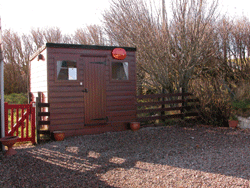
The village has the smallest post office in Mackay Country and no shop and no van deliveries. Provisions must be collected from Tongue or Bettyhill. Donreay provides most of the employment and when this establishment started crofting and local work all but disappeared. The village hall is the centre of community activities.
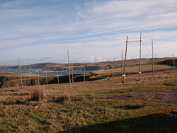
Armadale Bay lies between Ardmore Point to the west and Strathy Point to the east. The Armadale Burn flows northwards into the bay from Loch Buidhe Mor.
Armadale is a crofting community with a population of 51. 35% retired or unemployed Armadale’s population 19 years ago was between 60 and 70 then fell to 34 and now slowly moving back upwards. A Small Communities housing trust Albion Housing is building 2 houses. The community is comprised of Small crofts average 4 acres. There is no school as it closed in the closed in the 50’s and children attend Bettyhill. There is a Doctors surgery with 2.5 doctors practicing from serving the area from Tongue to Armadale.
The present village of Armadale dates from 1790 when John Mackay of Strathy sold all of his land.
“The age structure in Mackay
Country is older than the regional average…
Moves are underway to develop an old croft structure close to the road for interpretation and a wildlife access to the beach. Kyle’s Croft was identified after a successful summer of serving teas and coffee with sales of local produce. This coupled with the lack of proper access to Armadale beach prompted the community to pursue the purchase of the croft when it became on the market.
Armadale has a long stretch of sandy beach with vast expanse of flat sand when the tide is out. The township is scattered around the hill of the seas inlet and the bay. Accesses through rights of way on crofts and can be difficult to find and not really suitable for children. It requires a determined walk but offers excellent surfing. The building when converted will serve a divers selection of community activities, old crofting display, local studies and archival information, youth recreation, wild flower meadow, vegetable garden, native trees

Armadale Beach can also be reached by walking along the burn from the road bridge. The bay empties a good bit revealing a huge expanse of level, golden sand. Two burns run across the sand. It is a great beach for walking and playing with many rocks to climb on and pools to look in. It is very good for beachcombing particularly after a storm.
It is good for bathing and usually deserted. Armadale has wild Salmon netting and could be the last one operation. Because of pressures from landowners and river board many of these once common stations have ceased to exist.
Many people left the remote township of Pluriscraig to settle in Armadale; last to leave was in 1930.


WALK TO POULOURISCAIG
Ah, I do think as I do tread… all these roads
That we do bruise with horses’ shoes and heavy loads,
Be works that we’ve afound awrought
By our forefathers’ care and thought.(v)
Drive down Armadale village to the white bungalow called the Salmon Bothy There you will see a signpost to the deserted village of Poulouriscaig. Follow the track in front of the house and off up the hill. It is a steep and rough track. Look across to the horizon on your left during the early stretch of this path and see if you can see The Sleeping Beauty of Armadale. After about two and a half miles you will come to the ruins. It is lovely spot, very green where the inhabitants cleared the boulders and wrung a hard living from a reluctant land for over a century. It is very moving to see the fruits of their hard work, building their houses and byres, making bridges and shoring up the banks of the burn and having to bring everything to and from the place on their backs before eventually having to abandon it.
From the rocks above it, on a clear day, it is sometimes possible to see Soul Skerray, an isolated rock out in the Atlantic. There are also magnificent views of the rugged coastline to east and west. As you walk back down the hill, the village and the bay are laid out below you.